Wilpena to Marion Bay: 23rd -
We ended up spending 8 days at Wilpena doing several walks and the big one of 19 kls that smartened us up, it was a very restful and peaceful time and I managed to knock out a couple of paintings. It felt good to take up arms again although one day I was parked 6metres off the roadway amongst the weeds that had recently been tractor slashed, painting a magnificent gum tree (on canvas not the tree Brett), a young Parks Ranger pulled up in his 4wd and informed me in no uncertain terms that I wasn’t allowed to drive off road other people would follow and damage the flora (slashed weeds), although I felt that I was probably doing more good than harm, I kept my thoughts to myself and obligingly relocated. Unfortunately before I was completely re-organised the wind got up and my easel blew over, the palette of fresh paint splatting onto the gravel naturally wet side down, I caught the easel so ended with plenty of paint on myself. Perhaps I wouldn’t have been so polite if the young w***er had driven up then.
Heading for the York Peninsula:
Departure day from Wilpena was 23rd Nov, we had a good run to Port Augusta enjoying a tail wind for a change and stopping for a look around in the quaint old town of Quorn (corn) on the way down and where Nancy picked up a couple of the best Tee bone steaks I have ever eaten (she’s got a thing about butchers shops). Port Augusta we picked up new Visa cards, replacing the ones cancelled after someone lost hers last time we were in the city. Then of course the obligatory shopping to replace depleting stocks.
Our stop over for the night was Port Broughton on the York Peninsula, the temp when we arrived was 37C. The drive to Port Broughton was quite scenic alongside the southern Flinders Ranges through kilometres of fields of barley being harvested quaint old towns with beautiful old cottages and homes.
Wednesday 24th we awoke to rain, overcast conditions and quite cold, our destination was Marion Bay at the base of the York Peninsula and once again we travelled through grain growing areas where harvesting was in top gear and a continuous stream of grain trucks raced back and forth to Wallaroo where a large bulk carrier was being loaded for export.. Stops were made at several of the small towns enroute to Marion Bay most of these towns were established in the late 1850’s when rich copper ore deposits were discovered, a result of this was a large influx of Cornish miners and their families and this is revealed today in the heritage architecture of the region and the famous Cornish Pasties, which I can assure you tasted great.
Marion Bay is on the foot of the Yorke Peninsula and approximately 6 kls from the famous Innes National Park, the region is well known for its mining of Gypsum in earlier days, now days it is just a popular holiday fishing village (only the fish don’t know that).
Gypsum or hydrated calcium sulphate (CaSO4.2H2O) in other words calcium with water is used in the manufacture of plaster, plaster of paris, plaster board, ceiling board, mouldings, fertiliser a soil conditioner (as in breaking up clay ground) and even as an agent in Chinese medicine.
following are extracts from SA Government Gazette;
Like many towns, the population of the Marion Bay area developed in response to economic opportunity. Gypsum, a mineral used as an ingredient for plaster, was discovered in the area, and William Innes (after whom the mining village and the National Park are named) formed the Australian Gypsum and Whiting Company in the 1880s, to mine the gypsum leases in the area. As a substantial jetty was necessary to support the export of the large quantities of gypsum being mined, the Marion Bay jetty was built in 1889. Unlike other jetties on the Yorke Peninsula which were built for the export of primary produce, Marion Bay jetty was constructed with wooden tramway tracks, along which the gypsum was transported from the Inneston mining operations, located in what is now known as Innes National Park.
When operations were taken over by Mr A.A. Hassell in 1898, the original wooden tramway tracks were replaced with steel rails, and steam locomotives and side tipping trucks were installed to carry the gypsum down to the jetty. By the 1920s grain, wool and salt were also being shipped from Marion Bay. In 1930 nearby Stenhouse Bay took over the shipment of gypsum from lower Yorke Peninsula.
By 1970 Inneston had become a ghost town as mining operations ceased. Today the partially restored Inneston village and the stately heritage-listed Stenhouse Bay jetty provide excellent insights into the mining history of the region.
Other mining that has taken place on the Peninsula includes copper (Moonta Mines), lime (near Stansbury), dolomite (Ardrossan), and salt (Edithburgh and Price). Marion Bay has now developed into another popular holiday town on the Yorke Peninsula, offering swimming, surfing, fishing, boating, and bushwalking in Innes National Park.
During our 3 day stay at Marion Bay Nancy and I drove and walk numerous kls through the Innes National Park, the coastline around the park is quite rugged with steep high cliffs several of which have important lighthouses built on them to warn shipping of the local dangers, from these great vantage points fantastic views are had of the coastline, one in particular gives a 360 degree view and is quite sensational all of these locations are easily accessed by short relatively easy walks of a couple of kls at most and well worth the effort. We were very fortunate that the 2 days we decided to carry out our park sojourn the weather was kind to us and we were able to check out all of the important historical sites and most of the walking trails.
I walked down to a jetty to check out the fishing in this famous fishing place and chatted to a family who told me the only thing around was Tommy Ruffs and they’re good eating. Tommy Ruffs? So I waited and watched for a while, they use light gear and floats and suspend a bait above the bottom to avoid weed, then one excited member of the family pulled in what I was told was large Tommy Ruff or in other words Herring about the size of a gold fish and they eat the bloody things. I haven’t been fishing yet.
The weather changed piddled down all night and blew like hell, the morning was wet, windy and very cold. We chose to move on and took our time driving from one side of the York Peninsula to the other and back checking out the small villages enroute to Stansbury on the east coast of the York Peninsula, once again a renowned and popular fishing village with a very shallow bay beach right in front of the caravan park, once we were set up I wandered down the beach to chat to a couple of blokes fishing. The wind was howling overhead and it was freezing, these guys were local SA people and had heavy jackets and balaclavas on and they were cold as well, very un-seasonal they told me and it was obviously affecting the fishing. I haven’t been fishing yet.
To the north of the bay by about 750metres is a large jetty built for the old days of sailing ships but still in great condition and a mecca for fishing, apparently they catch blue swimmer crabs off the jetty and all sorts of fish according to another caravan occupier who had caught 17 blue swimmers just the other night, (their description sound like our sand crabs). At the other end of the bay is a groin and past this the beach is very flat so the tide goes out for ever and here they use a rake similar in appearance to a grass rake to wander through shallow clear water and rake up the blue swimmers (apparently), of course the weather has an effect on the results you don’t want any wind other wise you can’t see for ripples and of course it’s blowing its guts out now isn’t it, at least I’ve seen the rakes and had the method described. I haven’t been fishing yet.
Sunday, November 28, 2010
Thursday, November 25, 2010


Click Photos to Enlarge


Wilpena Caravan Park locals
the little parrots are Port Lincoln Parrots


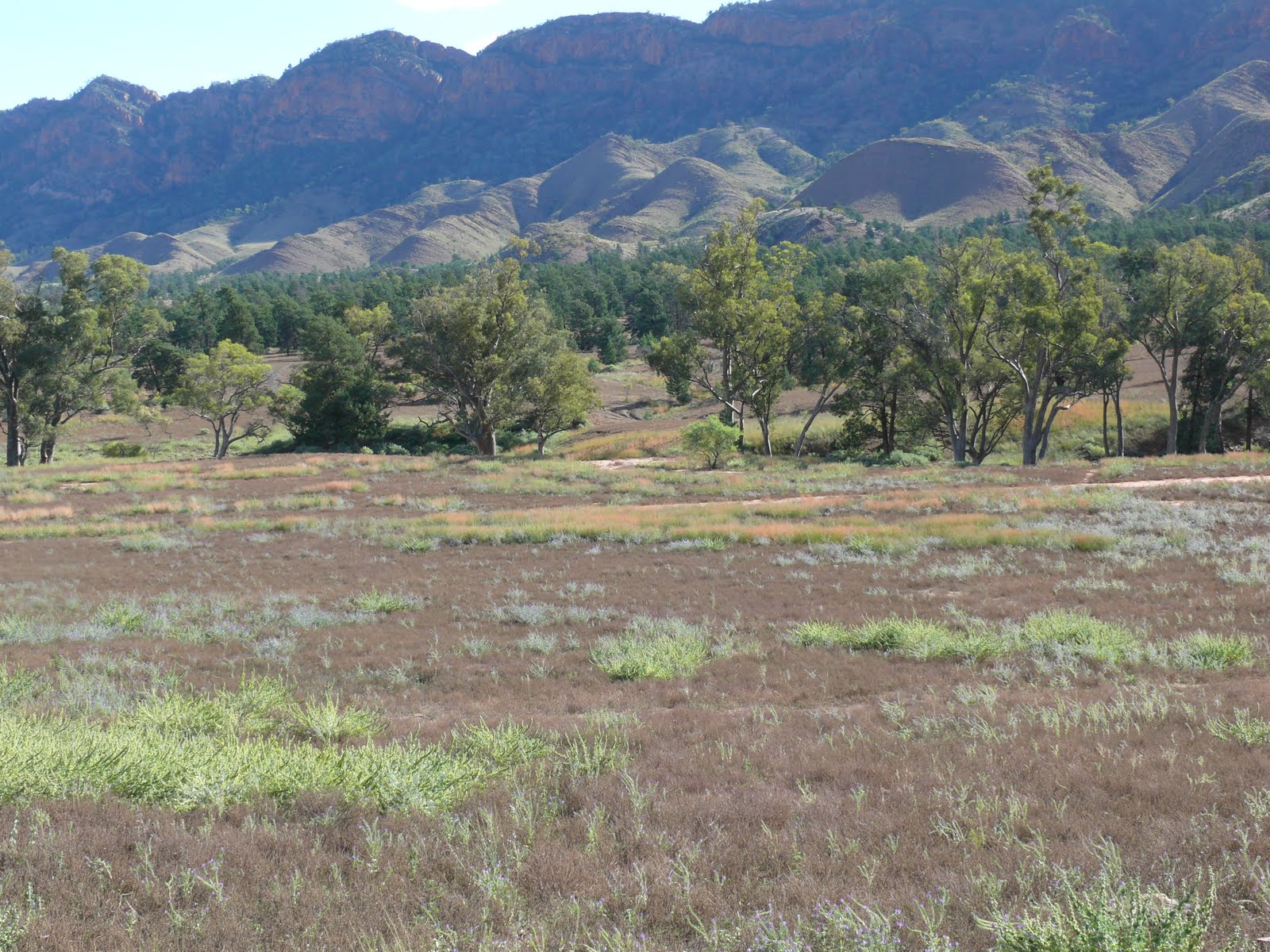
Flinders Ranges in the vicinity of Wilpena Pound

Saturday, November 20, 2010
Still at Wilpena 19th and 20th
Wilpena 19th-20th Nov:
Yesterday 19th we spent several hours wandering around the remnants of ‘Old Wilpena Station Precinct’ and reading about its history; this was a working station for 135 years and slipped into retirement in 1985. It is a fascinating place.
Today 20th we hiked across Wilpena Pound itself heading off at the early hour of 9:15am (some people just will not get out of bed). Bridle Gap Hike is 19kls return, by midday I was hearing plenty of complaints about the heat, the walk across the pound is very easy and basically flat, once pastures it is now a thin forest of small pines and gums gradually taking it back to its original self, grazing areas are still apparent and everywhere wild flowers create carpets of blue, yellow and white.
Trudging up the final kilometre was testing, the track weaving through stunted scrub wasn’t easy to walk on, resembling a dry creek bed of loose cobbles ranging from golf ball to rock melon size and climbing all the time it would have been quite easy to turn an ankle. We made the top of what is called the Bridal Gap this was and probably still is the only other way into the pound besides the main access area near where the caravan park is situated. This is also the track that Hans Heysen the famous South Australian artist used to follow. It was on discovery of these two openings in what can be described as steep rising escarpments, that the original pastoralists’ pioneered the pound.
From a vantage point under a shady tree we ate our vegemite sandwiches and awed at the view, resting and hiding from the sun for an hour Nancy was soon snoring while I explored the surrounding rock formations. Looking over the edge of this escarpment I could see Heysen’s track dropping away and winding down the escarpment which drops away quite steeply, almost vertically. It may have been considered as the other access to the pound but I couldn’t imagine anything other than a person on foot and perhaps tough sheep making it up to the pass. On our hike (ordeal) apart from the late variety of wild flowers we encountered the obligatory roos, a couple of broods of emus and a mob of wild goats looking very fearsome with their long horns. A long hot shower was sensational when we got back, we were both a little leg weary but I think the heat didn’t help, today as it turned out was the hottest we’d had since being at Wilpena, and Nancy agrees you need to start early. Regardless we both thoroughly enjoyed it and felt as if we had achieved something.
Friday, November 19, 2010
Wilpena Flinders Ranges
Wilpena 15th – 19th Nov 2010
We will end up staying here for a week it is quiet and restful with plenty to see and do, the caravan park is quite large and obviously caters for large numbers of tourists; fortunately it is very quiet at this time so the park only has a few caravans and hire camper vans. The ground is hard packed red shaley gravel, I don’t know how it would be if it rained but we won’t think of that, the gravel is not rocky so people are still able to drive tent pegs into it. Each parking bay although not drive through has plenty of room to reverse in and park with the van still attached if you so choose, set amongst small pine trees and gums it is a lovely atmosphere and the flies are not as troublesome as they were at Arkaroola and other places. There are several grassy gullies throughout the park with huge river red gums standing defiant against any force of nature to wash them away, sunlight filters through the trees, the abundant birdlife sets up a chorus of competing sounds and wallabies graze casually amongst the happy campers. Yesterday 18th while talking to our Canadian neighbours and cooking breakfast outside, a large wallaby or small Kangaroo (I never know the difference) came right up the table and had a look at the food deciding bacon and eggs wasn’t the go, a little later a single Emu wandered past our van casually pecking away at fresh shoots, and it’s so peaceful.
On the 16th, day after we arrived, we established what bush walks were attemptable and undertook a couple of relatively easy ones for a warm up to walking again. These trails involved walking through a forest of massive Gums with a carpet undergrowth of purpley blue Salvation Jane (Patterson’s Curse) wild flowers, it was absolutely beautiful and photos just don’t do it justice (ours don’t anyway). One of the trails involved a fairly steep rocky climb up a hill to a look out where we could see right into the pound one way and out out the other to the surrounding country side. Looking into the pound is similar to looking into an oval volcano crater 5 kls wide and 11 kls long only it is lushly covered in forest and pastures where early settlers actually grew wheat and grazed sheep although the forest has grown back substantially now.
Wilpena is thought to have meant cupped hand in the local dialect, pound was a term early settlers used to describe an animal enclosure.
17th Nov:
Spent the day driving all the scenic roads around the National Park and beyond. Bitumen road now takes you all the way to Blinman approximately 60 kls north from Wilpena, with little diversions off here and there on gravel roads to look outs or some heritage sites. Blinman is an old established village with quaint cottages and about 64 residents, one pub, one store, a post office and a café, but it caters for a few travellers and tourists with historical walks and old mine visits and is the only town between Hawker and Arkaroola 150 odd kls further north. After Devonshire tea we crossed country on a gravel road through beautiful gorges and undulating countryside along river beds splashing through clear running mountain streams, no wonder the roads close quickly when it rains we seemed to spend a lot of time bouncing along creek beds that form part of the road, everywhere the massive River Gums of all shapes and configuration. Reaching the bitumen road Hawker to Lyndhurst on the western side of the Flinders Range we turned south for 20 or 30 kls then back into the gorge systems striking similar views and road conditions, cobbled creeks, plenty of shallow water crossings and very corrugated roads, just glad I don’t have false teeth, thought the Toyo was going to fall apart. We arrived back at Wilpena just before 7:00pm, (sun doesn’t go down until about 8:30pm here). A full day but most enjoyable.
18th Nov: Rest day neither of us felt like doing much, it was one of those warm balmy days a lot of campers moved out, it was peaceful and quiet, Nancy wandered up to the park reception (shop) for some information (shop), I washed the caravan and made it look respectable again, did some maintenance in the car, read my book and even did a little painting. Nancy decided to ‘have a little lay down at 11:45 am before we have lunch’, at 3:30 pm she disputed the time. But it was one of those days nice and relaxing and you need them now and then.
Weather here has been beautiful so far with no rain, quite cool nights and lovely warm days, no draining humidity. It’s the 19th Nov: we are going to do a substantial walk today starting early, but as I sit here typing this blog at 8:50 am, listening to Nancy snore, I wonder. And there’s a cold breeze coming through the vent in the door even though I’m sitting here with a flannelette shirt on, our plans may change.
Thursday, November 18, 2010


Click Photos To Enlarge


On the road to Arkaroola in the Flinders Ranges including 100's of creek crossings like these, emus, and roos and our camp site at Arkaroola Caravan Park
Click to enlarge


Nancy eating Lamingtons
Young local kids after a chopper ride


Keeping out of the sun behind Marree Airport
Some wags up here


Flooded Cooper Creek and Birdsville Track
Punt or Ferry at the Cooper


Salt edge and start of Lake Eyre
Half way across Lake Eyre


Southern end
Dingoe fence and harsh country at its best
Tuesday, November 16, 2010


Leaving Arkaroola Flinders Ranges
This just about brings us up todate from my previous postings on 9th Nov since then we haven't had phones, internet or even domestic radio leave alone TV, can't remember the last time we looked at the goggle box. We did have 1 bar on the phone 1kl out of Lyndhurst at the top of the only hill, ankle deep in bull dust and chewing over friendly flies. - so I will endeavour to edit some photos and post them in next posting.
Leaving Arkaroola
We had intended leaving Arkaroola on Saturday 13th but during Friday night it rained pretty solidly resulting in all the creek crossings flooding and closing all the roads out, so we were forced to stay a couple of extra days and do a bit more exploring, how dreadful, it meant we spent a couple more nights sitting round a camp fire chatting and partaking (as you do) with our neighbours at the campsite, Bob and Shirley from Adelaide travelling with an off road Kimberley Camper who’s previous owner was none other than the well known Less Higgins ‘The Bush Tucker Man’. Bob and Shirley were great company and having travelled extensively had a few stories to tell, they want us to look them up when we are in Adelaide, Bob has promised to take me King George Whiting fishing and fishing for blue swimmer crabs, I’ll be keeping him up to that, but you know what it’s like around a camp fire, we were well oiled.
One of Bob’s stories, he and Shirl were in Vancouver at a trade commission, there was a young Canadian having difficulty filling out his Australian visa application, Bob asked him what the problem was and he responded “I have to name the hotel I will be staying at in Australia and I can’t remember the name, it starts with ‘B’ I think.” Bob suggested the obvious, Brisbane, Ballarat, etc,etc each time no, no, no, and jokingly Bob said “Birdsville” “Yes, yes that’s it” said the young fellow, to which Bob asked why the hell Birdsville, the young fellow looked at him and quite seriously said, “well it looks pretty central so if I base myself there I can do day trips to all the major cities like Brisbane, Sydney, Melbourne, Adelaide and perhaps even stretch it to Perth what do you think?”. !!!!
Intentions were to drive from Arkaroola to Wilpena Pond something like 200kl on gravel road but were informed the road was only open to 4wd but when you are pulling 3.2 tonnes you don’t risk things, so we drove back the way we came in 120 kls gravel and then another 215 kls to get to Wilpena, when we eventually arrived they told us the road was open to all traffic. Not happy Jan. Probably just as well we didn’t travel south though as the way we went we had to drive through bits of water but nothing serious.
Now we are at Wilpena Pound and it’s absolutely beautiful.
10th Nov Getting to Arkaroola Flinders Ranges
10th Nov 2010: Getting to Arkaroola:
Before we left Lyndhurst and the cheapest fuel north of Port Augusta at a $1.32/ltr (the publican owns the fuel bowser as well and all the trucks fuel up here before heading up Strzelecki Track to Moomba gas fields). We spent some time tapping up all external vents on the caravan other than the fridge as a precaution against dust ingress. Then we drove the 30 odd kls south to Copley where Nancy had to buy another quandong pie for herself. Before tackling the gravel road that starts right at Copley I reduced air pressure in all our tyres (as advised by those with more knowledge than me about these things) then drove the 120 plus kls across the range through station properties, National Parks and remote Aboriginal settlements, undulating country and so many dips into tree lined dry creek crossings that we lost count, I think we stopped at most of them to take photos some of those red river gums are magnificent, on we drove stopping occasionally to watch father emu usher his chick broods off the road to safer localities. – did you know the female emu lays eggs then the male bird has the sole responsibility of raising the chicks for two years, he will always position himself between any threat and the chicks during this period.
Road surface on this drive across from Copley to Arkaroola, changed constantly according to the natural rock in that locality, this ranged from good smooth gravel, clayey surfaces, to bloody awful. We travelled at around 50 – 60 kph sometimes less stopping occasionally in case someone wanted to pass, the dust we produced was so thick you couldn’t see a thing behind for ages only one vehicle passed on the whole trip – wouldn’t want to break down! Drains and creek crossings had to be slowed for although they were dry they were rutted and a lot of the crossings were just creek beds of gravel and cobbles. In all a slow trip but most enjoyable the caravan tows extremely well on the gravel and when we arrived there wasn’t a thing out of place and no dust inside the van other than a couple of small bottom storage cupboards over the wheel arches, an appropriate application of silicone rectified that.
11th – 15th Nov 2010: Arkaroola Flinders Ranges
We had read and heard a bit about Arkaroola an award winning Wilderness Sanctuary set in the magnificent north eastern section of the Flinders Ranges. Most people have heard about Wilpena Pound but there doesn’t seem to be a lot of information readily available about Arkaroola even though it is South Australias premier ecotourism destination. Arkaroola is 600 kls north of Adelaide and 3 hours north of Wilpena Pound. Facilities available at Arkaroola include accommodation, a restaurant, bar, store, fuel, tyre repairs, swimming pool and public telephones.
The setting is a lodge with above facilities and half a kilometre away through a gulley to the next ridge is a caravan park with power, bore water if you want to use it and the obligatory showers, toilet and laundry. The caravan park is a terraced set up reminding me a lot of an overgrown drive in movie theatre; each bay is basically drive through, has a small eco garden of shrubs and small trees separating it from the other bays and can cater for two vans in each. With the weather normally warming up at this time of the year it is recognised as the end of the tourist season, that being the case there was only ever a handful of vehicles in the park at one time so we had plenty of room, although it was noticeable how we all gravitated toward the amenity block to save walking – lazy bloody lot, we only parked there because the roadway was wider and I could turn more easily !
Surrounding the settlement area are close by hills of varying geological structure and scrub coverage, from here numerous 4wd trails lead to various distant historical points of interest or just plain vista attractions. Beautiful tree lined gullies and gorges with dry creek beds and occasional water holes abound and wind their way through steep craggy hills. We were seeing the countryside at its best in 20 years or more with a huge array of flowering shrubs and ground plants, Sturt Desert Peas and flowering spinifex grass spreading a golden sheen across darkened scrub on hillsides, tricking the eye into thinking the sun was shining through the clouds onto one particular area, areas that apparently are normally sparsely dotted with any growth at all, are now completely covered in green mainly the soft silvery green of saltbush. There are lots of walking trails that would be better undertaken in cooler times, we completed one short walk of 3 kilometres along a winding tree lined gorge on a cooler day and still found it bearable but rather hot for walking, we would definitely like to come back again only a month or two earlier and carry out some of these walks, you see so much more in the tranquillity of walking.
We also undertook a few driving tracks a lot of these are early geological prospecting tracks from thirty odd years ago or farm station tracks from earlier days, the nature of the terrain is such that growth does not re-establish on formed tracks the ground is so hard and rocky. These tracks or trails go for kilometres a lot of them are marked as one way and ‘whew’ are they a test of 4wd driving, I probably wouldn’t have attempted half the places I was forced to go knowing I had travelled so far and there was no turning back, I had my heart in my mouth a couple of times for sure but reassured by the knowledge that others had done it previously before me, we pressed on enjoying the experience and taking in the natural beauty of the place, but keeping in mind it is a remote area and we were the only ones around for yonks. I don’t think anyone would come looking for us if we didn’t arrive back at the van.
‘Ridge Top Tour”
One luxury we did allow ourselves was to embark on what is famously known as the ‘Ridgetop Tour’ (another Xmas present), 8 or 10 people normally squeeze onto the back of a Toyota 4wd in safari fashion, we were lucky there were only 5 of us thank god, a driver guide takes you over a ridgetop/gully tour where others are locked out of, it is rugged although you have a seatbelt on, you have to hang on, it is so steep and bumpy even though they go quite slowly, the V8 Toyota just chugged merrily up and down some of the steepest tracks I have seen. Driver guide Ryan, who for the rest of the year takes out camel trains across the desert, gave a running commentary on everything from Arkaroola’s history, the biodiversity of the region, geological history and of course his beloved camels, a very interesting, entertaining and knowledgeable young man. At the end of the trail is a very steep climb up to a look out where we were obliged to get off our chariot while Ryan turned the thing around this was a precaution as the area was so small it required a bit of tooing and froing and if he went over the edge he would hit the bottom for a fornight. We stopped here for coffee and the best lamingtons you’ve ever tasted and the view was spectacular, you could see for ever. This whole trip, tour whatever takes about four and a half hours and is worth every cent the views are spectacular the country is spectacular and the geology and biology is amazing, both Nancy and I considered this was even more impressive than flying over Lake Eyre.
Flinders Ranges in this region are laced with minerals of all types, Uranium was prospected and mined many years ago, rock being blasted from the hills and smashed up by sledge hammer, camel trains were used by Afghan handlers to pack ore out from these rugged in- accessible regions but for various reasons, mainly the remoteness and rugged inaccessible nature of the terrain, it wasn’t cost effective and the practices stopped, copper and gold has also been worked in the area at various times in a small way, amongst other minerals and about thirty or so years ago major exploration companies conducted significant exploratory drilling operations, one company even using a huge helicopter to move a drill rig from ridge top to ridge top. Even today considerable action is being undertaken by a group of investors to open up a uranium mine, needless to say there is a strong anti lobby against this taking place. They could never rehabilitate the area to its original state if mining took place, the tracks they cut 30 yrs ago are still usable the ground that hard it has not naturally grown over.
Reg Sprigg a geologist who basically kicked off Santos spent a lot of time in the region and was so fascinated by the area now called Arkaroola that he considered it worth conserving and ended up purchasing it in 1968 to create a sanctuary for endangered species Flora and Fauna. Today a weather station, observatory and seismograph station add to its significance. Up to 200 earthquake rumblings are recorded in this area each year.
11th – 15th Nov 2010: Arkaroola Flinders Ranges
We had read and heard a bit about Arkaroola an award winning Wilderness Sanctuary set in the magnificent north eastern section of the Flinders Ranges. Most people have heard about Wilpena Pound but there doesn’t seem to be a lot of information readily available about Arkaroola even though it is South Australias premier ecotourism destination. Arkaroola is 600 kls north of Adelaide and 3 hours north of Wilpena Pound. Facilities available at Arkaroola include accommodation, a restaurant, bar, store, fuel, tyre repairs, swimming pool and public telephones.
The setting is a lodge with above facilities and half a kilometre away through a gulley to the next ridge is a caravan park with power, bore water if you want to use it and the obligatory showers, toilet and laundry. The caravan park is a terraced set up reminding me a lot of an overgrown drive in movie theatre; each bay is basically drive through, has a small eco garden of shrubs and small trees separating it from the other bays and can cater for two vans in each. With the weather normally warming up at this time of the year it is recognised as the end of the tourist season, that being the case there was only ever a handful of vehicles in the park at one time so we had plenty of room, although it was noticeable how we all gravitated toward the amenity block to save walking – lazy bloody lot, we only parked there because the roadway was wider and I could turn more easily !
Surrounding the settlement area are close by hills of varying geological structure and scrub coverage, from here numerous 4wd trails lead to various distant historical points of interest or just plain vista attractions. Beautiful tree lined gullies and gorges with dry creek beds and occasional water holes abound and wind their way through steep craggy hills. We were seeing the countryside at its best in 20 years or more with a huge array of flowering shrubs and ground plants, Sturt Desert Peas and flowering spinifex grass spreading a golden sheen across darkened scrub on hillsides, tricking the eye into thinking the sun was shining through the clouds onto one particular area, areas that apparently are normally sparsely dotted with any growth at all, are now completely covered in green mainly the soft silvery green of saltbush. There are lots of walking trails that would be better undertaken in cooler times, we completed one short walk of 3 kilometres along a winding tree lined gorge on a cooler day and still found it bearable but rather hot for walking, we would definitely like to come back again only a month or two earlier and carry out some of these walks, you see so much more in the tranquillity of walking.
We also undertook a few driving tracks a lot of these are early geological prospecting tracks from thirty odd years ago or farm station tracks from earlier days, the nature of the terrain is such that growth does not re-establish on formed tracks the ground is so hard and rocky. These tracks or trails go for kilometres a lot of them are marked as one way and ‘whew’ are they a test of 4wd driving, I probably wouldn’t have attempted half the places I was forced to go knowing I had travelled so far and there was no turning back, I had my heart in my mouth a couple of times for sure but reassured by the knowledge that others had done it previously before me, we pressed on enjoying the experience and taking in the natural beauty of the place, but keeping in mind it is a remote area and we were the only ones around for yonks. I don’t think anyone would come looking for us if we didn’t arrive back at the van.
‘Ridge Top Tour”
One luxury we did allow ourselves was to embark on what is famously known as the ‘Ridgetop Tour’ (another Xmas present), 8 or 10 people normally squeeze onto the back of a Toyota 4wd in safari fashion, we were lucky there were only 5 of us thank god, a driver guide takes you over a ridgetop/gully tour where others are locked out of, it is rugged although you have a seatbelt on, you have to hang on, it is so steep and bumpy even though they go quite slowly, the V8 Toyota just chugged merrily up and down some of the steepest tracks I have seen. Driver guide Ryan, who for the rest of the year takes out camel trains across the desert, gave a running commentary on everything from Arkaroola’s history, the biodiversity of the region, geological history and of course his beloved camels, a very interesting, entertaining and knowledgeable young man. At the end of the trail is a very steep climb up to a look out where we were obliged to get off our chariot while Ryan turned the thing around this was a precaution as the area was so small it required a bit of tooing and froing and if he went over the edge he would hit the bottom for a fornight. We stopped here for coffee and the best lamingtons you’ve ever tasted and the view was spectacular, you could see for ever. This whole trip, tour whatever takes about four and a half hours and is worth every cent the views are spectacular the country is spectacular and the geology and biology is amazing, both Nancy and I considered this was even more impressive than flying over Lake Eyre.
Flinders Ranges in this region are laced with minerals of all types, Uranium was prospected and mined many years ago, rock being blasted from the hills and smashed up by sledge hammer, camel trains were used by Afghan handlers to pack ore out from these rugged in- accessible regions but for various reasons, mainly the remoteness and rugged inaccessible nature of the terrain, it wasn’t cost effective and the practices stopped, copper and gold has also been worked in the area at various times in a small way amongst other minerals and about thirty or so years ago major exploration companies conducted significant exploratory drilling operations, one company even using a huge helicopter to move a drill rig from ridge top to ridge top. Even today considerable action is being undertaken by a group of investors to open up a uranium mine, needless to say there is a strong anti lobby against this taking place. They could never rehabilitate the area to its original state if mining took place, the tracks they cut 30 yrs ago are still usable the ground that hard it has not naturally grown over.
Reg Sprigg a geologist who basically kicked off Santos spent a lot of time in the region and was so fascinated by the area now called Arkaroola that he considered it worth conserving and ended up purchasing it in 1968 to create a sanctuary for endangered species Flora and Fauna. Today a weather station, observatory and seismograph station add to its significance. Up to 200 earthquake rumblings are recorded in this area each year.
10th Nov 2010: Getting to Arkaroola:
Before we left Lyndhurst and the cheapest fuel north of Port Augusta at a $1.32/ltr (the publican owns the fuel bowser as well and all the trucks fuel up here before heading up Strzelecki Track to Moomba gas fields). We spent some time tapping up all external vents on the caravan other than the fridge as a precaution against dust ingress. Then we drove the 30 odd kls south to Copley where Nancy had to buy another quandong pie for herself. Before tackling the gravel road that starts right at Copley I reduced air pressure in all our tyres (as advised by those with more knowledge than me about these things) then drove the 120 plus kls across the range through station properties, National Parks and remote Aboriginal settlements, undulating country and so many dips into tree lined dry creek crossings that we lost count, I think we stopped at most of them to take photos some of those red river gums are magnificent, on we drove stopping occasionally to watch father emu usher his chick broods off the road to safer localities. – did you know the female emu lays eggs then the male bird has the sole responsibility of raising the chicks for two years, he will always position himself between any threat and the chicks during this period.
Road surface on this drive across from Copley to Arkaroola, changed constantly according to the natural rock in that locality, this ranged from good smooth gravel, clayey surfaces, to bloody awful. We travelled at around 50 – 60 kph sometimes less stopping occasionally in case someone wanted to pass, the dust we produced was so thick you couldn’t see a thing behind for ages only one vehicle passed on the whole trip – wouldn’t want to break down! Drains and creek crossings had to be slowed for although they were dry they were rutted and a lot of the crossings were just creek beds of gravel and cobbles. In all a slow trip but most enjoyable the caravan tows extremely well on the gravel and when we arrived there wasn’t a thing out of place and no dust inside the van other than a couple of small bottom storage cupboards over the wheel arches, an appropriate application of silicone rectified that.
Monday, November 15, 2010
Marree and Lake Eyre
9th November with a certain amount of excitement we headed off to Marree for our scheduled flight over Lake Eyre, keeping in mind this was what had possessed us to proceed south so directly and not delay too much site seeing on the way. Really I don’t know if I was excited about seeing bloody Lake Eyre or the fact that once we had done it I could go into super slow mode, and I am inclined to think there was quite a bit of the later in my mood.
Whereas the landscape from Hawker north includes views and a reasonable proximity to the western side of the Flinders Ranges, by the time you get to Leigh Creek you have moved further away and the landscape becomes flat arid looking desert country covered in silvery green salt bush that has its own beauty particularly if you don’t have to live there. On the way to Marree we detoured slightly to have a look at ‘Farina’ a ghost town remains of a town once called ‘Government Gums’ the townsfolk were so sure of its grain growing potential that it changed its name to Farina, meaning flour. The remains can be seen of the original 2 pubs, churches, one or two shops a school, police station and a brothel that we couldn’t find, although most of it now is brick remains and junk its history is interesting and it was amazing how many people from Farina served in the two great wars.
We also discovered a really nice grassed area for camping in the creek area behind the ruins, with flushing toilets and showers based on an honesty box system, turns out it is referred to in the Camps Australia Wide book 5, certainly a place worth remembering for future trips in this locality.
We arrived at Marree around mid-day, this is a description of Marree from one of our Travel Books: ‘Marree is the perfect image of a tiny outback town’, it’s the start (or finish) of the Birdsville and Oodnadatta Tracks. ‘The settlement was established in 1872 as a camp for the overland telegraph line construction and also became the rail head for the Great Northern Railway later to become the Ghan’. Marree serviced all travellers and workers heading north including the famous Afghan traders who drove their camel trains into the deserts playing a significant role in opening up the outback, old occupied houses in an area known as the Afghan quarter look like they may well be remnants of the era.
Marree is a small settlement in a large salt plain desert, it was bloody hot and the flies too friendly, we went to the pub for lunch as the story has it the pub is a great place and really good food, a small tourist bus was in and its occupants were in the pub having very well barbequed sausages and last weeks salad (lets face it the nearest Fresh food Woolies is 340 something Kls away in Port Augusta). The publican, not young but a huge man glared at us for even stepping foot in the hotel and promptly growled when asked, the counter lunch was $15.00 you guessed it, very well BBQ sausages and salad ALL YOU COULD EAT, literally there was nothing else, and no way Nancy was going to pay $15.00 bucks for sausages Christ!!! So we went back to where we had confirmed our flight boarding pass at the servo and paid $9.00 each for a hamburger, with the works mind you. By this time it was 1:00pm and we weren’t due out at the airstrip until 3:45pm, this would then give us an opportunity to sightsee Marree, which we did and after that at ten past 1:00pm we found the only tree giving some shade and parked there for the next few hours trying to be positive. We did drive a hundred metres up the Birdsville Track so we can say we have driven on the Birdsville Track. (big deal).
3:45pm saw us out at the airstrip crowding behind the airport office (demountable shed) with a bunch of aboriginal kids their teacher and a couple of mums all of us trying to get some shade and collectively flapping at the ever friendly flies. The kids were taking it in turns three at a time to have a helicopter ride, take off one circuit of the town and land, all just a few minutes but the look on their faces on return was something to behold, thank you Julia Gillard.
Our plane was a single engined 7 seater piloted by a lovely young lady celebrating her 21st birthday, she was a very competent pilot who’s objective is to fly for the Royal Flying Doctor Service. Nancy being the smallest had to sit on her own right at the back, I was the heaviest so I got to sit up front as co pilot, not that I’m over weight it’s just the other people were all frail looking, and regardless we all had a good view.
Once airborne our course tracked in a straight line for the Cooper Creek where a ‘punt’ ferries cars and cattle on hoof across the flooded Cooper, below us the Birdsville Track snaked from one side of the plane to the other, sporadic side tracks indicating where station homesteads are situated, the land is red and sparsely green we are seeing it at the best its been in 20 years and even from 3,000ft it still looks hard and desolate and so remote.
We dropped to 500 odd feet and did a big U turn round the punt then heading west all the time flying over the flooded Cooper, reminding me a lot of the wetlands around Kakadu, water birdlife was abundant with flocks of black swans, pelicans and numerous other smaller species probably ducks and the like scattering out below us like giant fans still not acceptant of the noisy big bird above them. Our lovely young pilot with her long fair hair and slim legs clad in tight jeans (can’t remember her name I’m not very good at remembering names) explained to us that because of the salt content of Lake Eyre there was very little bird life around the lake and most of it was to be found around the Cooper where we were currently flying at around 500 feet or so. And so onward we flew westward leaving the Cooper well behind until eventually shimmering in the distance a long white slick stood out on the horizon and as we got closer the white turned to blue, then a shore line was apparent and we were suddenly flying over Lake Eyre North, the white we could see was the dry salt layer edge exposed as the lake receded or was never covered by water, as you fly above the water it looks a pinky colour (don’t know why), we flew on passing over several small islands where we could see a few pelicans but that was all and you got the distinct impression the water wasn’t very deep I believe a couple of metres at most and being brown with a very high salt content I would suggest that is what is reflecting the light to look a pinky colour. Eventually when we could just see a horizon in the western distance we turned south to head for home and once again fly over arid sparse country with just the odd station road visible and kilometre after kilometre of sand dunes all running parallel in one direction. We crossed the dingo fence and shortly after we were once again in sight of Marree township all up two hours flight time, what a fabulous experience, that’s our Xmas present to ourselves we’ve been extravagant with our presents this year.
And so we returned to Lyndhurst satisfied we had finally seen something that had only happened 3 times in 150 years and even it happens again next year who cares we’ve seen Lake Eyre with water in it.
I cannot remember off hand, statistics from our flight but I do remember that the lake is extremely salty, far saltier than the sea and a lot more salty than the Dead Sea so theoretically you shouldn’t be able to sink in it and obviously there are no fish in it. Our flight was two hours flying time, 4 – 6:00pm a really good time, the sun being low in the sky meant shadows were cast and therefore features stood out better than if the sun was directly overhead.
A cold beer at the Lyndhurst Hotel was very welcome and it was one of those nights that the temperature didn’t want to come down.
8th and 9th Nov 2010 : Hawker – Lyndhurst
After overnighting at the Flinders Ranges Caravan Park in the small town of Hawker we continued 192 kls north to Lyndhurst, passing through several small villages on the way such as Copley comprising a general store, Leigh Creek pub, a mechanical repair come servo and a pie shop. The pie shop is famous for quandong pies, these are apparently a wild fruit and make a delicious fruit pie, Nancy forced me to have one.
We stopped for a look at Leigh Creek this is a very modern little settlement that caters for the Leigh Creek coal fields, small but well set out, very clean and environmentally established, nice school and shopping centre. I believe Leigh Creek is the main centre for the Dep Transport in this region, every vehicle that drove into the shopping centre had 3-4 people all with Hi Viz clothing either from the mines or road authority. It turns out that Leigh Creek was originally located 13 kls to the north but as a result of valuable coal reserves around the area, Leigh Creek was relocated to its present location in 1982 and hence the emphasis on tree planting etc to create such an attractive oasis in what you would call a fairly desolate region. The huge open cut coal mine produces brown coal for Port Augusta power generation, the station was modified specifically to be able to burn this particular brown coal, a two kls long train carts 10,000 tonnes per day.
Lyndhurst is 37 kls north of Leigh Creek and is the last of the sealed road, this is also the turn off point to the Strzelecki Track (yes I’ve spelled it correctly it’s up to you to pronounce it). This track is the road to Moomba oil and gas field and further on to Innamincka, it was surprising how many large trucks and fuel tankers were heading in that direction, the drivers telling me it’s slow going and hard on gear.
We camped in the Lyndhurst Caravan Park, that means a closed off compound alongside the pub on hard packed gravel, power but no water, showers and toilets were clean and we were able to draw hot water from the laundry for washing dishes etc, the water out here is bore water and not suitable for drinking so we conserved all of our on board water for cooking and drinking. We stayed two nights at Lyndhurst enabling us to drive the 80m odd kls of gravel to Marree where we had arranged to do the flight over Lake Eyre.
Monday, November 08, 2010
Week_2 South Australia
Continuing on the Barrier Highway we crossed into SA a few Kls west of BH, travelling most of the day through flat un-interesting country parallel to the rail line eventually stopping for the night at a free camp one kl before the town of Peterborough well know for it enthusiasm about trains a result of its history with trains being the key intersection between all of the major SA towns. Apparently in its prime a total of 105 trains travelled the Broken Hill to Port Pirie line in one day mammoth effort (250 Explore Australia).
While we camped a goods train passed slowly by loaded with containers some refrigerated and as the three engines pulling it entered Peterborough the last truck past us, we were one kilometre from town.
After Peterborough the landscape gradually improved and we started cruising through sheep and wheat country with rolling hills and distant ranges, what a pleasant change to the monotonous flatland desert region we had traversed for days, Nancy even stayed awake.
Arriving at Port Augusta for the first time since we had left Brisbane we could see blue water, the Spencer Gulf. At the Port we took on board fuel and filled up with water, where we are going is only bore water and not recommended for drinking, rain water is at a premium and only for drinking not for topping up caravans, shopping at woolies for fresh groceries was also necessary. You double back from Port Augusta a few kilometres and then head north toward Lake Eyre through interesting towns like Quorn (corn), where we will spend some time on the way back down, Hawker where we spent the night, Leigh Creek a working coalmine town and Lyndhurst end of the bitumen. We have a flight booked for Tuesday pm from Maree 80 kls to the north on a dirt road.
This is a scenic road with great views of the western side of Flinders Range, old stone ruins presumably once farm houses can often be be seen and magnificent river gums lining dry creek beds. - more later.


On the road to Broken Hill, flat horizon in all directions note how green the desert is.
Hill  top sculptors at BH.
 top sculptors at BH.
Nancy amongst Patterson's Curse or Salvation Jane depending upon where you are from this wild flower weed was prolific throughout NSW and SA. Nancy is the one with the hat on.
Red flower is Sturt desert pea wild flower.
Sunday, November 07, 2010
Broken Hill
We found Broken Hill to be a tidy city with plenty to see and do, there are numerous art galleries and a large contingant of well known resident artist that have chosen B/Hill for their base. Pro Harts gallery is run very successfully by his wife, his daughter also has her own gallery, Jack Absalom is another well known artist identity, he has quite a substantial set up and still personally works there and there are numerous others. By driving round the streets we discovered numerous lovely old miners cottages and civic buildings, we enjoyed a 2hr historical walk with one of lifes characters, he was an 83 year old ex underground miner who had a miriad stories to tell and his wealth of historical knowledge was fantastic, it was very entertaining.
A couple of clicks out of town the B/H council have established a "living desert" this is a living display of desert flora and forna from the region plus a large hill where several international sculptors have established a display of large modern rock statues on the crest of the hill, once again it was educational and interesting to walk around this reserve taking several hrs to do so.
24 kls NW of B/H are the remnants of an old silver mining town called Silverton once a prosperous mining town it is now more a tourist attraction with its old buildings and numerous ruins, now it is home to a few artists and their galleries, drawn to the area like Broken Hill by the variety of the desert and the contrast of the surrounding ranges. A lot of the film Mad Max was filmed in this locality, plus A town like Alice and several other well known movies including Priscila Queen of the Desert were filmed both here and B/H.
And there was a lot more to see and do.
Photos week_1


Free camping at Florida half way between Nyngan and Cobar western NSW Barrier Highway.
The open cut in Cobar where they are still extracting on a small scale now. Further north of Cobar CRA operates the largest copper mine in NSW.


Qld water has the Darling river in flood and a derelict
old building in Wilcannia 202 kls east of Broken Hill far western NSW
Subscribe to:
Posts (Atom)